
Craigmillar Castle Park
Welcome to the landing page for the Craigmillar Castle Park permanent orienteering course. You can download maps using the links below. For more information about permanent orienteering courses (POCs) and for maps for other POCs managed by Interlopers Orienteering Club, visit our Permanent Courses page.
Area
Craigmillar Castle Park, Edinburgh (view Craigmillar Castle Park in a larger map)
Access Points
- Bridgend Farmhouse, Old Dalkeith Road, EH16 4TE (OS Gridref NT 279710)
- Approach road to Council Recycling Centre, Old Dalkeith Road, EH16 4TB (OS NT 283709)
- Castlebrae Avenue, EH16 4DQ (OS NT 287713)
Please consider using public transport or active travel to access the park.
- By train: Nearest station is Edinburgh Waverley. Lothian Buses service 14 runs over North Bridge (stops on Leith Street and South Bridge either side of Waverley) and will take you close to the venue.
- By bus: Lothian Bus services 2, 12, 14 and 30 pass close to the park entrance (Peffermill Road)
- By car: you can park on local streets, but please be considerate to local residents.
Terrain
Mix of woodland and open grassland, with a good path network. Some steepness in places and some pockets of complex navigational detail.
Maps
Course maps are available as PDFs to download below for free.
Courses
Courses using this set of permanent orienteering course markers are available with different lengths and navigational challenge:
- White is the shortest and easiest, suitable for child beginners
- Yellow is easy
- Orange is intermediate (a good starting point for adults with some map skills)
- Light Green is longer and more challenging
To find out more about orienteering courses, see https://www.scottish-orienteering.org/get-involved/what-is-orienteering/.
Start points are marked on course maps with a Triangle, and Finish points are marked with a double circle. The finish is often at the same location as the start to allow a circular course. Find the posts with the letter codes in the order below. Walk, jog or run!
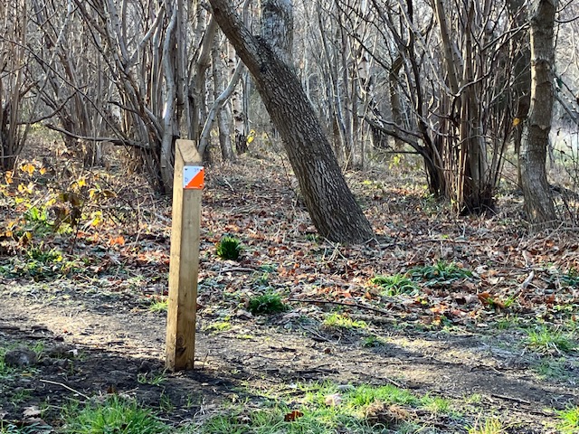
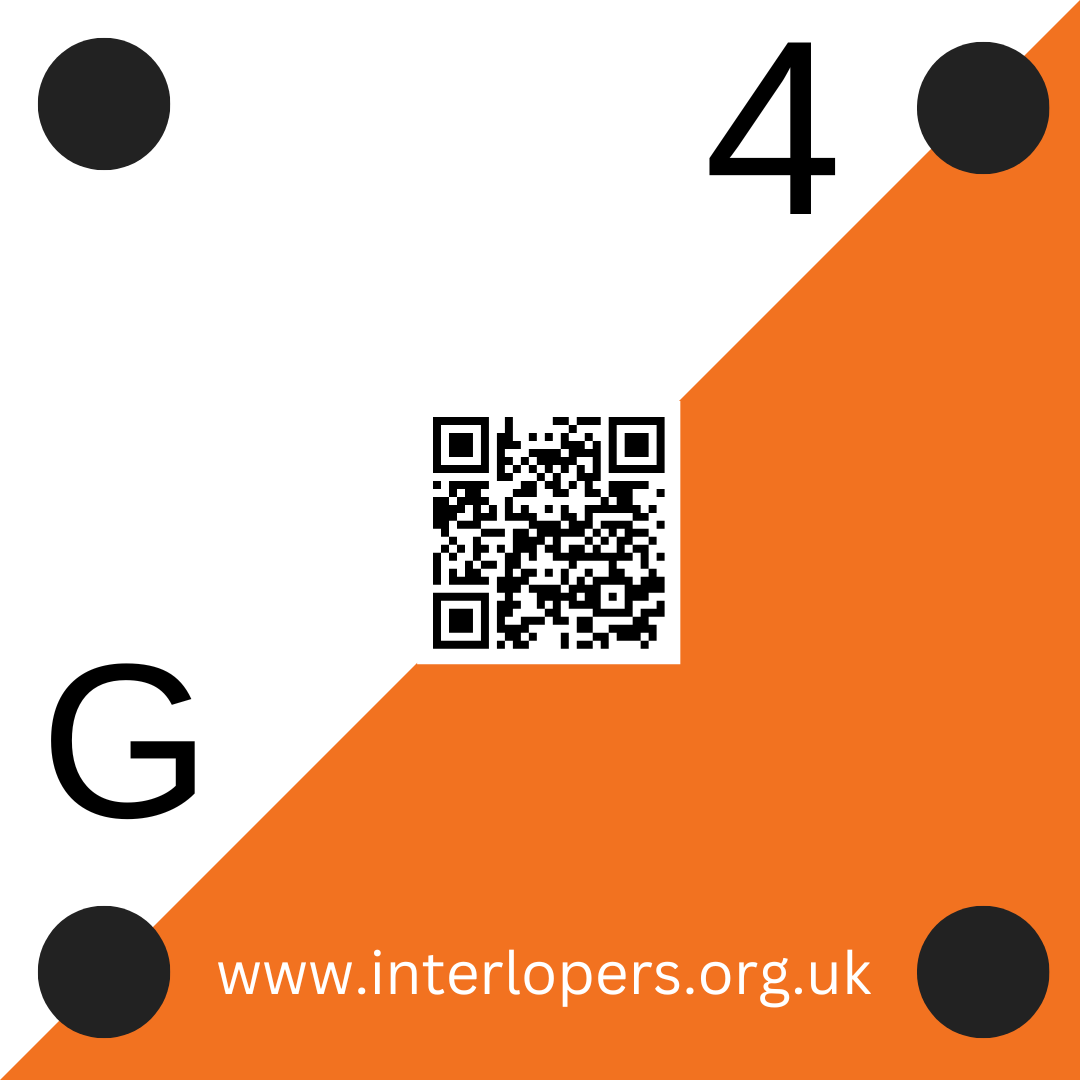
(Example post and marker plate)
Wear appropriate clothing and footwear for the conditions, and take particular care on slopes if wet.
Please respect areas marked as Out of Boards (purple hatching), including the footpath south of the Castle to the houses, and areas fenced in by Historic Environment Scotland. Be aware that grazing livestock may sometimes be present in this area too.
If you come across any damaged or missing markers or posts, please let us know via development@interlopers.org.uk. Any feedback on how you enjoyed your course(s) would also be welcome.
Orienteering Using the Maprun App
The Maprun App lets you do ‘smartphone orienteering’ – if you open up the course on your phone and pass the Start point, you’ll then get a ‘beep’ every time you find a control. There’s also a leaderboard in the app. Use the links below to find a course. Alternatively, you can use the ‘Events Near Me’ function in the app, or ‘Select Event’ – then go to UK / Scotland / Edinburgh / Craigmillar Castle / Permanent Courses. For any queries, contact development@interlopers.org.uk.
Bridgend Farmhouse Start
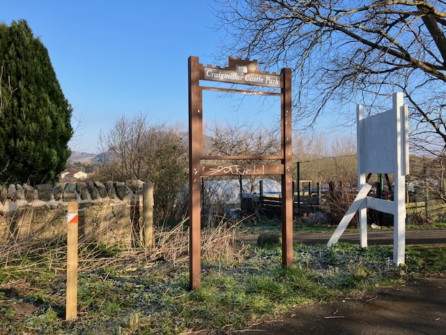
Start / finish is on the cycle path near the farmhouse, by the signposts in the photo below:
| Course | Length | Map PDF |
Maprun Link (Click on phone) |
QR for Maprun (Scan with phone) |
| White 1 | 1.5 km | Bridgend Farmhouse White 1 | Coming soon |
Coming soon |
| White 2 | 1.7 km | Bridgend Farmhouse White 2 | Coming soon |
Coming soon |
| Yellow 1 | 2.1 km | Bridgend Farmhouse Yellow 1 | Open in MapRun |
|
| Orange 1 | 2.2 km | Bridgend Farmhouse Orange 1 | Coming soon | Coming soon |
| Orange 2 | 3.0 km | Bridgend Farmhouse Orange 2 | Coming soon |
Coming soon |

Castlebrae Avenue start
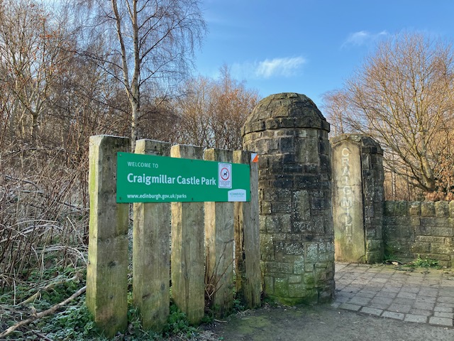
Start / Finish is at the park entrance, shown in the photo below:
| Course | Length | Map PDF |
Maprun Link (Click on phone) |
QR for Maprun (Scan with phone) |
| White 1 | 0.9 km | Castlebrae Avenue White 1 | Coming soon |
Coming soon |
| White 2 | 0.9 km | Castlebrae Avenue White 2 | Coming soon |
Coming soon |
| White 3 | 1.0 km | Castlebrae Avenue White 3 | Coming soon |
Coming soon |
| Yellow 1 | 1.6 km | Castlebrae Avenue Yellow 1 | Coming soon |
Coming soon |
| Yellow 2 | 1.7 km | Castlebrae Avenue Yellow 2 | Coming soon | Coming soon |
| Yellow 3 | 1.1 km | Castlebrae Avenue Yellow 3 | Coming soon |
Coming soon |
| Orange 1 | 2.9 km | Castlebrae Avenue Orange 1 | Coming soon | Coming soon |
| Orange 2 | 2.6 km | Castlebrae Avenue Orange 2 | Coming soon |
Coming soon |
| Light Green 1 | 2.5 km | Castlebrae Avenue Light Green 1 | Coming soon | Coming soon |
Playpark Start
Start / Finish are at the playpark - easiest access is from approach road to recycling centre, or alternatively from Castlebrae Avenue.
| Course | Length | Map PDF |
Maprun Link (Click on phone) |
QR for Maprun (Scan with phone) |
|
White 1 |
1.1 km | Playpark White 1 | Coming soon | Coming soon |
|
White 2 |
1.0 km | Playpark White 2 | Coming soon | Coming soon |
|
White 3 |
1.1 km | Playpark White 3 | Coming soon |
Coming soon |
|
Yellow 1 |
1.3 km | Playpark Yellow 1 | Coming soon |
Coming soon |
Course Solutions
Did you find the correct letters in the right order, as you went round your course? Each checkpoint post has a number, listed in the table in your course map, as well as a letter. See below to check your route!
More Information
For more information on how to enjoy permanent orienteering courses, email development@interlopers.org.uk.
This Permanent Orienteering Course was redeveloped in 2025 with grant funding support from City of Edinburgh Council, and with practical work undertaken by Edinburgh & Lothian Greenspace Trust.
For general queries about Interløpers Orienteering Club, contact the Secretary via info@interlopers.org.uk or tel. 0131-440-2136.